Making Weather Visible: 3 Engaging Activities for Air Masses and Weather Fronts
Air masses and weather fronts are tough because the most important parts are invisible. We talk about warm air rising, cold air sinking, and fronts moving across a map, but students are often just staring at red semicircles and blue triangles hoping it clicks.
For me, the goal is to make weather visible. Students need to see what happens when air masses meet, move their bodies a little, and then read the details carefully enough to use the vocabulary correctly.
Here are three air masses and weather fronts activities that help students understand the science behind the forecast.
1. Show fronts with a density tank demo
This is one of those demos that is worth the setup. If students can see cold water slide underneath warm water, they have a much easier time understanding why cold fronts can create quick, intense weather changes.
Use a clear container and divide it in the middle with a piece of cardboard or plastic. Fill one side with cold blue water and the other side with warm red water. When you lift the divider, students can watch the denser cold water move under the warmer water.
Then connect it back to the atmosphere. Cold air is denser. Warm air is forced upward. Rising warm air can lead to clouds, storms, and changing weather. It is a simple visual, but it gives students something real to remember.
2. Act out weather fronts with body movement
Middle schoolers may act like they are too cool for this, but most of them secretly enjoy getting out of their seats. I like assigning students to be warm air molecules and cold air molecules.
- Warm air students stand farther apart and move a little faster.
- Cold air students stand closer together and move more slowly.
- For a cold front, the cold air pushes forward and forces the warm air to rise.
- For a stationary front, both sides push but neither really wins.
It can get a little silly, but that is not always a bad thing. If they remember the movement later when they see a weather map, the activity did its job.
3. Use an Air Masses & Weather Fronts gallery walk
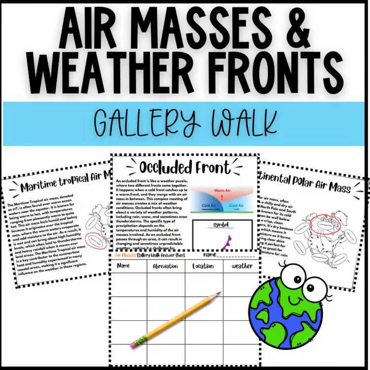
After students have a visual and a movement activity, they still need the details. They need to know the types of fronts, the symbols, the air mass names, and the weather that usually comes with each one.
That is why I like this Air Masses & Weather Fronts Gallery Walk. It turns the reading part into an active lesson. Students rotate through stations on cold, warm, stationary, and occluded fronts, plus continental polar, maritime polar, continental tropical, and maritime tropical air masses.
Each station includes a diagram, symbol, and short reading passage. Students draw, describe, and record the weather conditions as they go. I like that they end up with a study guide they built themselves instead of one I just handed them.
You can grab the Air Masses & Weather Fronts Gallery Walk here.
Forecasting success
Weather lessons work best when students have more than one way to process the concept. Let them see density. Let them act out the fronts. Then get them reading, drawing, and writing about what each weather front means.
Hopefully these air masses and weather fronts activities help your students move from memorizing symbols to actually understanding what is happening in the sky.
Ready-to-use classroom resource
Want this science resource ready to print?
Save planning time with a classroom-ready activity built for upper elementary and middle school teachers.
For a fuller weather unit, connect this with global and local winds, severe weather activities, or ocean currents.
